


 Been there
 Want to go
 Ask friends for recommendations
Things to do
outdoors
 hiking
 climbing
 waterfalls
 mountains
 canyons
 whitewater
 horseback riding
 adventure
 camping
 woods
woods
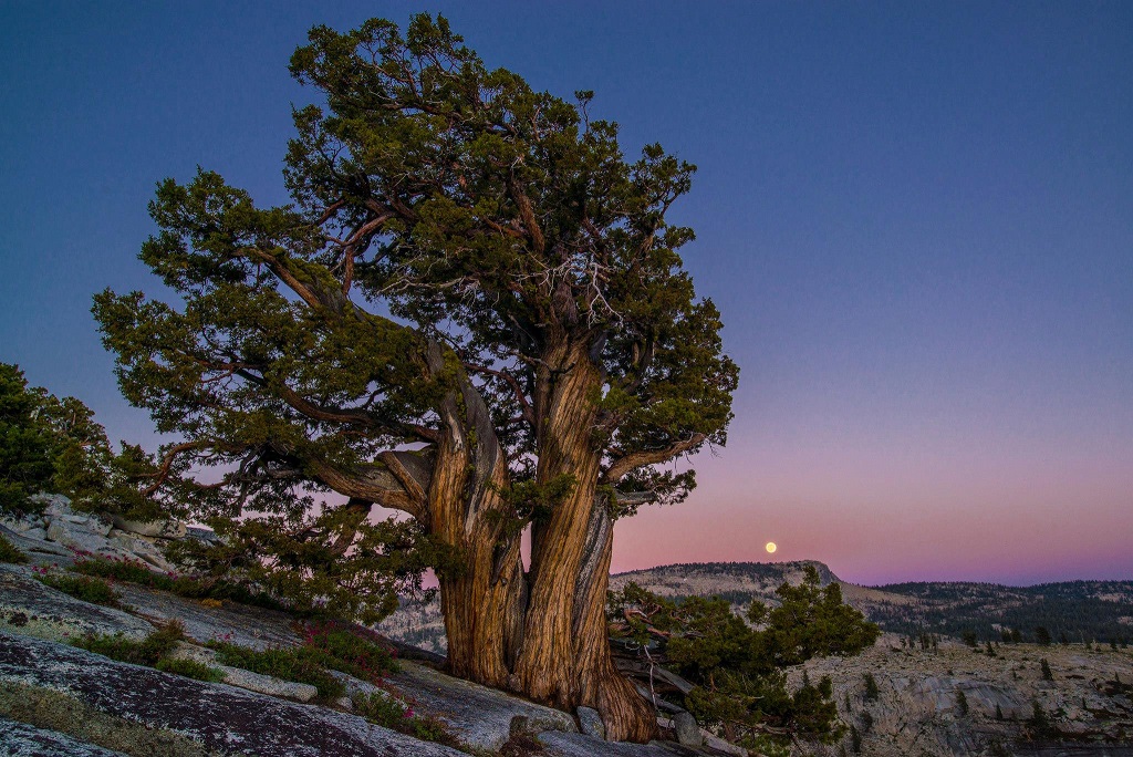
 flora
flora
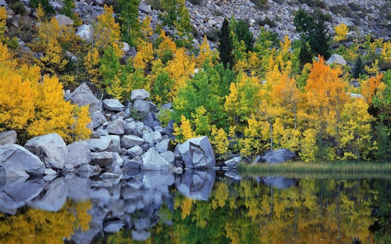
 lakes
lakes

- Enjoy views of magnificent cliffs and waterfalls.
- Hiking, ranging from safe same day family style to multi-day camping trips in High Sierra wilderness.
- World-class climbing, including legendary El Capitan and Half Dome.
- Challenging white water rafting and kayaking.
- Hiking, ranging from safe same day family style to multi-day camping trips in High Sierra wilderness.
- World-class climbing, including legendary El Capitan and Half Dome.
- Challenging white water rafting and kayaking.
Attractions and sights
 View Map

-
Yosemite Valley
 Yosemite Valley is world famous for its impressive waterfalls, meadows, cliffs, and unusual rock formations. The valley floor is flat and forested, with Merced river in the middle. A few campgrounds, cafeterias and a pretty expensive hotel are situated there. Most of the sights can be seen from a driveway, which, however, during the peak summer months can become one giant parking lot. Hiking up the trails provide better vistas.

-
El Capitan
 The granite monolith extends about 3,000 feet (900 m) from base to summit along its tallest face, and is one of the world's favorite challenges for rock climbers. Its The Nose wall was first climbed in 1958 in 47 days using "siege" tactics: climbing in an expedition style using fixed ropes along the length of the route, linking established camps along the way. Today, The Nose typically takes fit climbers 4–5 days of full climbing. The record currently belongs to Alex Honnold and Hans Florine, with a time of 2:23.46
-
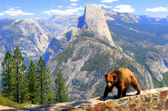
Half Dome
 Perhaps the most famous sight in the valley is the granite monolith of Half Dome. The granite crest rises 4,700 ft (1,500 m) above the valley floor. Today, Half Dome may now be ascended in several different ways. Thousands of hikers reach the top each year by following an 8.5 mi (13.7 km) trail from the valley floor. The final pitch up the peak's steep but somewhat rounded east face is ascended with the aid of a pair of post-mounted braided steel cables. Alternatively, over a dozen rock climbing routes lead from the valley up Half Dome's vertical northwest face. Their route has now been free soloed several times in a few hours time.
-
Vernal and Nevada Falls
 This two-waterfall cascade is sometimes called the giant staircase. The Emerald Pool forms on the "step" between Nevada Fall and Vernal Fall downstream. The hike to the top of Nevada Fall, along the Mist Trail, is 3 miles (4.8 km) from the trailhead in Yosemite Valley. One must first hike to Vernal Fall and then trek another 2 miles (3.2 km) to reach the top. The John Muir Trail, which starts near the trail to Happy Isles, goes to the top of Nevada Fall.
-
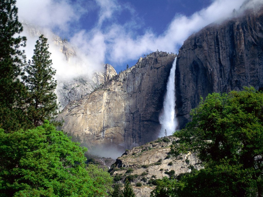
Yosemite Falls
 Yosemite Falls is one of the highest waterfalls in the world at 2425 feet (780 m), and is most impressive during the spring months. Lower Yosemite Fall is easily accessible from the Valley. The top of Upper Yosemite Fall may be reached via a steep, strenuous, and usually crowded 3.5 miles (5.6 km) hike, leading to an observation deck with fantastic views atop. It may also be reached via several routes from the Tioga Road to the north.
-
Giant Sequoias of Mariposa Grove
 Massive, ancient giant sequoias live in three groves in Yosemite National Park. The most easily accessible of these (spring through fall) is the Mariposa Grove near the park's South Entrance. Two smaller—and less visited—groves are the Tuolumne and Merced Groves near Crane Flat. No roads enter the Tuolumne or Merced Groves; two to three miles of hiking (about 500 feet of elevation gain) is required before you will see giant sequoias.
-
Glacier Point
 Glacier Point is a cliff-side viewpoint 3,200 feet (980 m) above Yosemite Valley. The point offers a superb view of Yosemite Valley, including Yosemite Falls, Half Dome, Vernal Fall, Nevada Fall, and Clouds Rest. It can be reached by car or by hiking up Four Mile Trail. Another 8 mi (13 km) trail runs from Glacier Point down to the Valley, via the Panorama Trail, past Nevada and Vernal Falls.
-
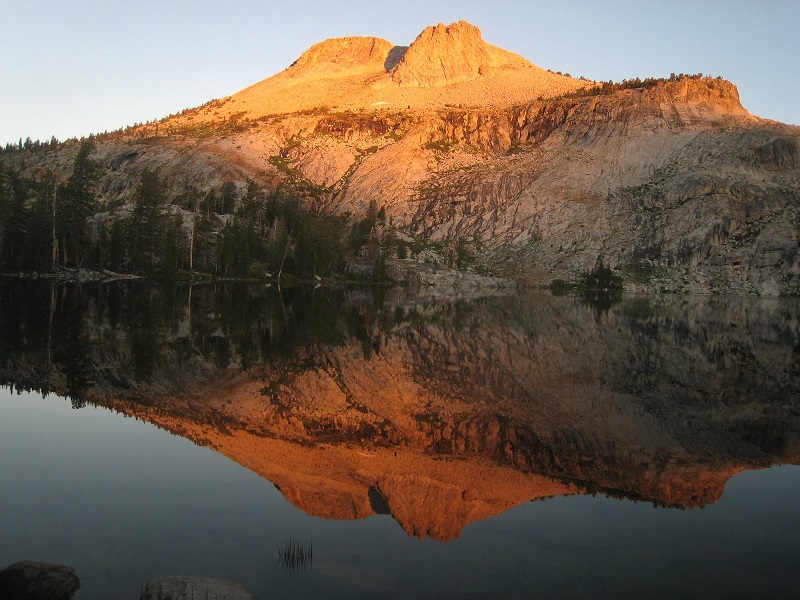
Tuolumne Meadows
 Tuolumne Meadows is a large, open sub-alpine meadow graced by the winding Tuolumne River and surrounded by majestic peaks and domes. Within Tuolumne Meadows, visitors see the Tuolumne River meandering quietly through its meadow channel and cascading over the granite river bottom against a backdrop of rugged mountain peaks and glacially carved domes.
More attractions
Hide Map


When to go
| |||||||||||||||||||||||||||||||||||||||||||||||||||||||||||


Best time to go:
Best in late May and June, when the waterfalls are full of water, off of snowmelt. Still very good through September, though dryer. November to April, the Valley is OK, but the upper trails are impassable due to snow.
Where to stay


 Ask friends for recommendations
How to get there
By car, from San Francisco Area airports (SFO, SJC, OAK): 200 mi / 4 hr
Reviews